Andy Burnelli
2022-07-18 07:28:11 UTC
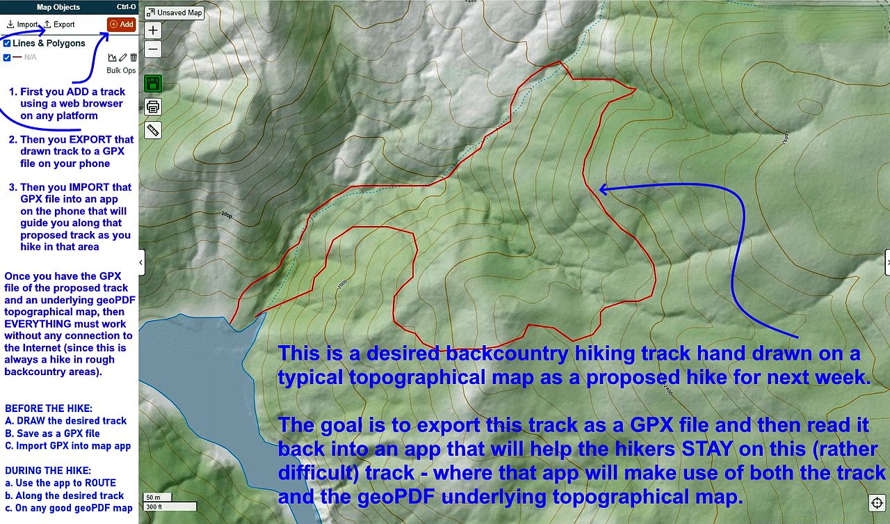
Do you know of Android freeware that allows you to import a proposed GPX
file hiking track which was perhaps drawn by hand, and then "navigates" it
telling you audibly when you deviate from the track while you're hiking it?
It could speak, for example, "Head East 100 Feet to get Back on Track", or
it could provide some other audible indication of "routing" on an otherwise
featureless hand drawn GPX track (for example, from "Caltopo" web tools).
Currently I import the desired hiking GPX track into any decent custom
geoPDF map reader (such as Avenza, Paper Maps, Offline Maps, Custom Maps,
Pocket Maps, etc.) and then I look at my current location "blue dot"
compared to the desired track (red line) and adjust my steps accordingly.
<https://play.google.com/store/apps/details?id=com.Avenza>
<https://play.google.com/store/apps/details?id=ca.abbro.androidmap>
<https://play.google.com/store/apps/details?id=net.psyberia.offlinemaps>
<https://play.google.com/store/apps/details?id=com.custommapsapp.android>
<https://play.google.com/store/apps/details?id=com.starcom.pocketmaps>
That works - even with non-custom topo map apps (such as US Topo Maps).
<https://play.google.com/store/apps/details?id=com.atlogis.northamerica.free>
But that visual comparison of current and desired location requires holding
the phone in my hand which is hard to do when navigating on steep mountain
hillsides so what would be best are audible directions to keep me on track.
--
Note for the USA, OSM topographic maps are generally useless for highly
contoured off-trail areas such as those I hike in the Santa Cruz Mountains.
Note for the USA, OSM topographic maps are generally useless for highly
contoured off-trail areas such as those I hike in the Santa Cruz Mountains.